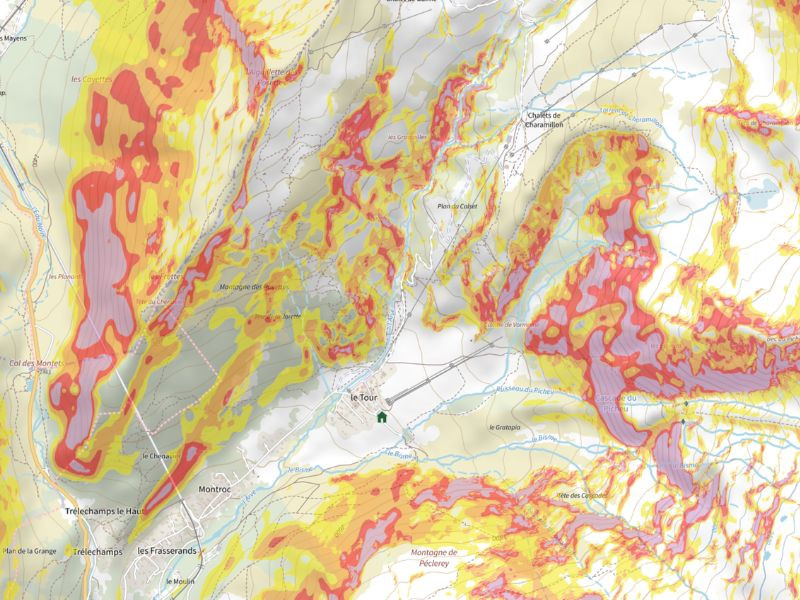
IGn slope map

2026 March 1 - In the headlines
Overlay the slope map on your basemap
Have you ever used the slope map on Trace de Trail and Trail Connect?
Available in the Layers tab, the IGN slope map allows you to instantly visualize terrain steepness using a clear color code:
- yellow: 30–35°
- orange: 35–40°
- red: 40–45°
- purple: > 45°
A particularly useful tool in the mountains, both in winter and summer, to identify steep areas, anticipate risks, and refine your terrain analysis.
It can be overlaid on your usual basemap, making it a powerful addition when reviewing a route before setting off… and it can also support you live in the field, in both 2D and 3D views on Trail Connect. A simple habit to adopt for a more informed, safer, and better-controlled outdoor experience.
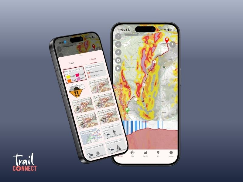


 Trail Connect